
The question the imagery has to answer
A compliance monitoring program does not buy pixels. It buys the ability to answer one question about one place at one time, in a form somebody else can check. That framing decides everything downstream: which constellation, which cadence, which processing level, and how much of the answer the imagery can carry before a person on the ground has to finish the job. Programs that go wrong usually go wrong right here. A sensor gets picked because it is free and looks detailed, and then the revisit interval turns out to be longer than the event, or the product on the screen turns out to be a screening indicator no rule recognizes.
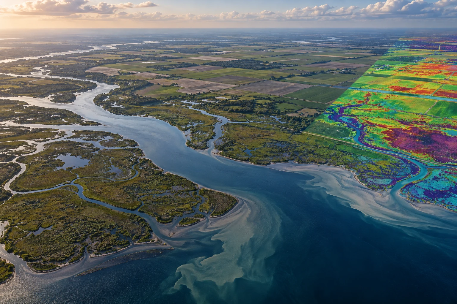
Three things belong on paper before any procurement: the shortest event the program must catch, the smallest area it must resolve, and the consequence of being wrong. A quarterly land-cover change in a 40-acre disposal cell and a two-hour flare event at a wellpad are different problems with different instruments, and no analytics converts one into the other.

What is actually flying in 2026
The civil medium-resolution record narrowed last year. Landsat 7, launched in April 1999, received its final transmission from USGS on June 4, 2025 after 26 years in orbit. The Landsat record now rests on two spacecraft: Landsat 8, launched February 11, 2013, and Landsat 9, launched September 27, 2021. Each images the entire Earth every 16 days, and the two fly in an 8-day offset, so every location gets a Landsat observation every eight days.
On the European side, Sentinel-2 is temporarily richer than its design. Sentinel-2C launched September 5, 2024 and took over operations from Sentinel-2A on January 21, 2025. Sentinel-2A was not retired: it maneuvered to a position 36 degrees from Sentinel-2B, resumed observations on March 13, 2025, and ESA has prolonged that extension campaign to December 31, 2026. Through the end of this year the constellation is three satellites rather than two. Any program that has to work in 2027 should be sized against the two-satellite case.
Sentinel-1 is mid-handover. Sentinel-1D launched in November 2025, open access to its data became effective April 17, 2026, and overlapping operations ran from mid-April to the end of June 2026, after which Sentinel-1C and Sentinel-1D became the operational pair. Two-satellite C-band SAR gives a six-day exact repeat; one satellite alone repeats every twelve days. Most global landmasses are imaged every twelve days, with Europe and areas of rapid change at six.
Two more sources belong on the shortlist. Sentinel-3 carries the Ocean and Land Colour Instrument at 300 m, the input to EPA's freshwater cyanobacteria product. And NASA's Harmonized Landsat Sentinel-2 project publishes HLSL30 and HLSS30, version-2.0 surface reflectance products that put Landsat 8 and 9 OLI and Sentinel-2 MSI on a common 30 m grid and deliver global land observations every two to three days. Sentinel-2's native 10 m and 20 m bands are resampled to 30 m in the process. Spatial detail goes down; one consistent series across two satellite families comes back.
One caution on single-instrument programs. MethaneSAT, launched in March 2024 and among the most capable methane-tracking instruments in orbit, lost contact with mission operations on June 20, 2025 and is likely not recoverable. An architecture that depends on one spacecraft inherits its single point of failure.
Continuity is a procurement risk, not a science problem
Landsat 9 was built to a five-year on-orbit design life and carries fuel for at least ten. The follow-on — described for several years as Landsat Next and now designated Landsat 10 — is expected to launch in 2031. NASA released the Landsat 10 spacecraft request for proposals through SAM.gov on July 14, 2026, with proposals due August 13, 2026 and a launch readiness date no later than December 2031.
The design changed along the way, so anyone who sized a program against earlier published figures should re-check them. USGS now describes the Landsat 10 instrument suite as 26 bands — 21 visible-to-shortwave-infrared and 5 thermal-infrared — with ground sample distances of 10 to 20 m for the visible, near-infrared and shortwave-infrared bands and 60 m for the atmospheric and thermal bands, and lists an 18-day revisit. The FY 2026 President's Budget restructured the mission and directed USGS and NASA to identify more affordable approaches to Landsat data continuity. USGS has also signaled a Collection 3 reprocessing in the late 2020s, concentrated in the Level-2 surface temperature and emissivity products.
Operationally: a baseline that has to hold past 2030 should assume Landsat 8 and 9 carry the record alone until then, and the pipeline should be built so Sentinel-2, HLS, or a commercial source can carry the series if one of them stops. Swapping sensor families after the fact rewrites every threshold calibrated against the original.
The data policies, read carefully
Landsat. USGS made Landsat data available over the internet at no cost in 2008, and the policy has held since. The data are in the public domain, including the copies held in commercial cloud buckets. There is no license to accept, no attribution obligation, and no restriction on redistribution or derived products. A Landsat-derived exhibit can go into a public docket without a rights review.
Copernicus. Sentinel data is free, full and open under EU law, and the grant is broad: reproduction, distribution, communication to the public, adaptation, modification, and combination with other data. The practical difference from public domain is that there is a licence text and an attribution expectation, and the obligation runs with the derived product. Read the current Copernicus Sentinel data licence before publishing under a government seal. Access runs through the Copernicus Data Space Ecosystem, which replaced the older access hub.
Commercial imagery. None of the above applies. Commercial optical and SAR arrive under an end-user license, and four terms decide whether the imagery is usable for compliance work: who counts as an authorized user, whether a contractor and its government customer are both covered, whether derived products can be published, and whether the underlying scene can be attached to a file that later becomes public. Settle all four before the first tasking order.
One related point gets confused often. NOAA's Office of Space Commerce licenses private US remote sensing space systems under 15 CFR Part 960, with the tier categorization at §960.6 turning on whether substantially the same unenhanced data is already available from unlicensed sources, licensed sources, or neither. That regime binds the satellite operator, not the buyer. It creates no obligation for an agency using licensed data, but it explains why one vendor can sell what a competitor cannot.
Revisit math decides the program
The cadence question is not how often a satellite passes overhead. It is how often a usable observation of one place arrives. Cloud is the whole difference. An eight-day Landsat cadence over the Gulf Coast in July is not an eight-day observation cadence, and a program planned on the orbital number under-delivers on the days that matter.
Three honest ways out. Stack sensors, which is what HLS does to reach two to three days. Move to SAR, since Sentinel-1 sees through cloud, works day or night, and answers a narrower question set — surface change, water extent, ground movement, vessel presence — very well. Or buy tasking, which converts a cadence problem into a budget and licensing problem. Most mature programs run a public baseline layer plus a commercial tasking line for the sites where timing matters.
Write down the shortest event the program must catch, then compare it with the median cloud-free observation interval for that place and season. If the event is shorter than the interval, the imagery is a trend instrument and not a detection instrument, and something else — a ground sensor, a continuous monitor, a complaint intake — has to catch the event. That comparison takes an afternoon and keeps a two-year program from being aimed at the wrong thing.
| Source | What it answers well | Cadence and scale | Cost and license |
|---|---|---|---|
| Landsat 8 / 9 | Long-baseline land change, surface temperature, disturbed ground, water extent | 30 m reflective bands; every location every 8 days | No cost; public domain; no attribution obligation |
| Sentinel-2 | Vegetation condition, spill and disturbance footprints, site-level change | 10 / 20 / 60 m by band; three satellites through end of 2026 | No cost; free, full and open under the Copernicus licence |
| Sentinel-1 (C-band SAR) | Change under cloud or at night, inundation, subsidence, vessel presence | 6-day exact repeat with two satellites; most global land at 12 days | No cost; same Copernicus licence terms |
| Sentinel-3 OLCI | Freshwater and coastal water colour; cyanobacteria screening | 300 m; weekly composites in EPA's public product | No cost; EPA redistributes a derived product |
| Harmonized Landsat Sentinel-2 | Dense, consistent series where cadence beats spatial detail | 30 m harmonized grid; global land every 2 to 3 days | No cost; NASA distribution via Earthdata and the LP DAAC |
| Commercial optical and SAR | Site detail and time-of-day control; tasking against a known event window | Sub-meter to meter; on-demand, subject to tasking priority | Per scene or subscription; end-user license governs publication |
Where remote sensing is already written into a federal rule
The best guide to how far satellite and airborne data will carry is to look at the places a federal rule has already adopted it, and read how narrowly the role is drawn.
The Super Emitter Program. Under 40 CFR 60.5371b, a super-emitter event is a methane release of 100 kilograms per hour or greater. Local regulatory agencies and EPA-certified third parties may notify EPA of such an event at or near a facility, using EPA-approved remote sensing technologies. EPA reviews the submission for completeness and accuracy, then notifies the owner or operator, which triggers an obligation to investigate, report, and address any leak found. Certification is a real application process: Carbon Mapper Inc. applied on November 5, 2024 and was assigned third-party ID TPN-0001 for airborne mobile remote sensing. EPA extended the program's implementation date through an interim final rule issued July 31, 2025.
Appendix K to 40 CFR Part 60. The optical gas imaging protocol is what a codified remote-sensing method looks like when it is finished. The camera must produce a detectable image of methane at 17 grams per hour, and either propane at 18 grams per hour or butane at 5 grams per hour. The protocol names the component classes to be surveyed — valves, flanges, connectors, pumps, compressors, open-ended lines, pressure relief devices, seal systems — and specifies survey conditions and verification. The existing-source guidelines also allow alternative test methods using advanced methane detection technologies for periodic screening or continuous monitoring, and EPA publishes the approved alternatives.
The Cyanobacteria Assessment Network. EPA runs CyAN with NASA, NOAA, and USGS, using Sentinel-3 OLCI at 300 m to produce weekly maximum cyanobacteria values for more than 2,370 resolvable lakes and reservoirs across the continental United States, delivered to state environmental and health agencies through the CyAN app and CyANWeb. It tells a state where to send a sampling crew this week. It is not a water quality determination.
The pattern holds across all three.
The regulatory floor is moving under the program
Anyone building a monitoring system in 2026 should treat the rule set as a moving input rather than a fixed one. Four live examples, all consequential for what a system has to produce:
- Greenhouse gas reporting — In September 2025 EPA proposed removing the 40 CFR Part 98 requirements for all source categories other than petroleum and natural gas systems, and suspending obligations for the remaining subpart W segments until reporting year 2034. In February 2026 EPA extended the reporting-year-2025 deadline from March 31, 2026 to October 30, 2026 while it works through comments.
- Oil and gas air standards — EPA finalized a reconsideration on April 4, 2026, published April 9, with technical changes to temporary flaring provisions for associated gas and to continuous monitoring of net heating value of vent gas from flares and enclosed combustion devices. EPA estimates $2.5 billion in industry savings from 2024 through 2038 at a 3 percent discount rate.
- Fine particulate standard — EPA lowered the primary annual PM2.5 standard from 12.0 to 9.0 micrograms per cubic meter, effective May 6, 2024. On March 12, 2025 the Administrator announced EPA would reconsider it. That reconsideration is unresolved.
- NPDES electronic reporting — The Phase 2 compliance date under 40 CFR Part 127 moved to December 21, 2025. Authorized state programs may seek EPA approval to postpone a general permit to an agreed date no later than December 21, 2028, and EPA gave notice in November 2025 of more time for reports using EPA's electronic tools.
The design lesson repeats in every case: separate the measurement layer from the rule layer. Store observations with acquisition metadata and processing lineage intact, and express thresholds, averaging periods, exceptions, and reporting formats as versioned configuration. A pipeline with 9.0 micrograms hard-coded into a query, or a March 31 date hard-coded into a scheduler, needs an engineer every time a rule moves. One that holds those as parameters needs an edit and a re-run, and can reproduce last year's answer under last year's rule when someone asks.
Screening signal versus compliance determination
Two questions get collapsed constantly, and they are different. The first is whether the agency may look. The second is what the observation proves.
On the first, the governing case is old and still load-bearing. In Dow Chemical Co. v. United States, 476 U.S. 227, decided May 19, 1986, EPA hired a commercial aerial photographer with a standard precision mapping camera to photograph a 2,000-acre chemical plant from lawful navigable airspace after Dow declined an on-site inspection. The Court held this was not a search prohibited by the Fourth Amendment: EPA used a conventional commercial camera commonly used in mapmaking rather than a unique sensory device unavailable to the public, and EPA needs no explicit statutory provision to employ methods of observation commonly available to the public at large. Reading that as blanket authorization for any sensing modality is a mistake. The reasoning leaned on the conventionality of the instrument, which is exactly the axis along which sensing has moved since 1986.
On the second question, the Exceptional Events Rule is a clean illustration. Under 40 CFR 50.14, an air agency asking EPA to exclude event-influenced data provides an initial notification and then a demonstration containing a narrative conceptual model, a showing that the event was not reasonably controllable and not reasonably preventable, a showing that it was a natural event or a human activity unlikely to recur there, and a clear causal relationship between the event and the monitored exceedance. Satellite fire and smoke products support the conceptual model and the causal narrative well; the exceedance itself still comes from the regulatory monitor. That is the shape across media. Imagery locates, prioritizes, and corroborates. The figure that carries legal weight comes from an instrument with a published method behind it.
How much of a determination each source can carry alone
Editorial weighting of how far each source travels alone, based on how current federal rules treat it. Illustrative, not a measured statistic.
The pipeline that holds up when the result is contested
Seven practices separate a monitoring pipeline that survives a challenge from one that does not. None are about the model.
Archive the acquisition, not just the product. Keep the scene identifier, timestamp, sensor, processing level, and collection version. Public archives get reprocessed — the coming Landsat Collection 3 will change surface temperature values — and an answer that cannot be tied to its exact input cannot be defended two years later.
Record the processing lineage. Atmospheric correction, cloud mask, resampling, mosaicking, and index computation each move the number. Store the chain and the software versions with the output.
Version the masks. Cloud and quality masks are the most common silent source of a false trend. A change in mask behavior between product versions looks exactly like a change on the ground.
Keep the coordinate story straight. Record datum, projection, and geolocation accuracy, and be explicit about what happens at a parcel or permit boundary. That is where analytics meet a legal description, and a 15-meter shift can move a finding across a fence line.
Report uncertainty with every derived number. A detection with no stated confidence and no stated detection limit invites a challenge that has nowhere to land. A stated limit — the way Appendix K states one — narrows the argument to facts.
Log the negatives. Record the dates a site was observed and nothing was found, and the dates no usable observation existed. Absence of a detection and absence of an observation are different, and a program that cannot tell them apart will claim the wrong one.
Make it re-runnable. Can the program regenerate a two-year-old result from archived inputs and pinned code? If not, the result is an assertion.
What belongs in the statement of work
For an agency or a consultancy putting this out for bid, the terms below decide whether the delivered system is usable. They cost nothing to include and are expensive to retrofit.
- Named source list with processing level and collection version, not "satellite imagery"
- A stated detection target — smallest feature, shortest event, accepted miss rate
- Cloud-free observation cadence by site and season, analyzed before the build, not claimed after it
- License chain for every commercial source, covering authorized users, derived-product publication, and public-file attachment
- Provenance and lineage records as a delivered artifact, not an internal convenience
- Reproducibility acceptance test — regenerate a named historical result from archived inputs
- Thresholds and reporting formats as versioned configuration, with a documented change procedure
- Continuity plan naming the substitute source if a primary sensor is lost, and the recalibration that triggers
Who is buying this work
The federal demand signal for commercial geospatial analysis is visible in contract structure. The National Geospatial-Intelligence Agency runs two five-year indefinite-delivery contracts under the Luno program with a combined ceiling of $490 million. Luno A carries a $290 million ceiling across ten companies for commercial GEOINT-derived computer vision and analytic services covering global economic and environmental activity and military capabilities. Luno B carries a $200 million ceiling across thirteen companies for services characterizing economic, environmental, and geopolitical activity along with illegal, unregulated and unreported activity. The Luno B selectee list runs from satellite operators such as Planet Labs Federal and Maxar Mission Solutions, through integrators including BAE Systems and CACI Federal, to advisory firms including Booz Allen Hamilton and Deloitte. Operators, integrators, and consultancies compete on the same vehicles.
Civil and state demand runs on a different model. EPA builds a derived product once and distributes it to state agencies, as CyAN does. The work there is less about collecting imagery and more about turning a national screening layer into a state's workflow: routing a weekly alert to the right district office, joining it to permit and sampling records, and closing the loop when a crew reports back.
Common questions on where the line sits
Can a satellite detection alone support an enforcement action?
In the federal programs that have adopted remote sensing so far, it does not have to. The super-emitter path uses a third-party detection to trigger a notification, which triggers an operator investigation and report. The imagery starts the process; the operator's findings and any follow-on inspection carry it. Designing imagery as the trigger rather than the verdict is the easier path.
Is free public imagery good enough, or is commercial tasking necessary?
It depends on the event duration and feature size written down at the start. Landsat and Sentinel-2 handle recurring, area-scale change at no cost and with no license friction. Commercial tasking earns its price when the program needs a specific place on a specific day, or detail finer than 10 meters.
What does a vendor claim of "continuous monitoring" usually mean?
Ask for the observation cadence at the specific sites, after cloud screening, over the last three years of archive. That one request separates orbital revisit from delivered observations, and it is answerable from public data in a day. If a vendor cannot produce it, the claim has not been tested against the geography that matters.
Frequently asked questions
Yes. USGS made Landsat data available at no cost in 2008 and the open policy has held since. The data are in the public domain, with no license to accept and no restriction on redistribution or derived products.
Landsat data are public domain with no attached terms. Copernicus Sentinel data is free, full and open under EU law, granting reproduction, distribution, adaptation and modification — but there is a licence text and an attribution expectation that travels with derived products.
Landsat 8 and 9 together deliver an observation every eight days, and NASA's harmonized Landsat and Sentinel-2 products reach global land every two to three days at 30 meters. Cloud cover reduces all of those substantially in humid regions and wet seasons. Sentinel-1 C-band SAR is unaffected by cloud.
Two clear places. The Super Emitter Program at 40 CFR 60.5371b sets a 100 kilogram per hour methane threshold and allows EPA-certified third parties to notify EPA using approved remote sensing technologies. Appendix K to 40 CFR Part 60 is the optical gas imaging protocol, with a required camera sensitivity of 17 grams per hour for methane.
The Supreme Court held in Dow Chemical Co. v. United States (1986) that EPA photographing an industrial complex from lawful navigable airspace with a conventional commercial mapping camera was not a prohibited search. The holding rested on the conventionality of the instrument, so it does not cover every modern sensing modality. Bring counsel in before a novel sensor is used for enforcement.
Bottom line
The satellite supply for environmental monitoring in 2026 is good and mostly free, and it is also narrower and more schedule-dependent than it looks. Two Landsat spacecraft carry a record whose successor is not expected before 2031. Sentinel-2 is temporarily three satellites and will be two again. Sentinel-1 just finished a handover. The data policies are stable and generous; the rules that define what has to be measured are moving month to month.
The programs that work write down the event they must catch before choosing a sensor, treat imagery as the thing that finds and corroborates rather than the thing that decides, keep rule parameters out of the code, and can regenerate any past result on demand. That is unglamorous engineering, and it separates a monitoring system somebody defends from one somebody quietly stops citing.